

Below Dartford the tourist river ends and the industrial one begins: tank farms, jetties, loading arms and ships working around the clock. A look at the product tanker Balvenie alongside a Thames terminal, and why this stretch is a hard subject from the ground and a simple one from the air.
Ask somebody to picture the Thames and they will give you the two miles between Tower Bridge and Greenwich. The part of the river that pays for itself is thirty miles downstream of that, where the channel widens, the banks go flat, and the tank farms start.
This stretch handles fuel, chemicals, aggregates, cement, cars and containers. It runs continuously, it is almost entirely invisible to the public, and it is photographed far less than any equivalent piece of national infrastructure.
A ship doing its job
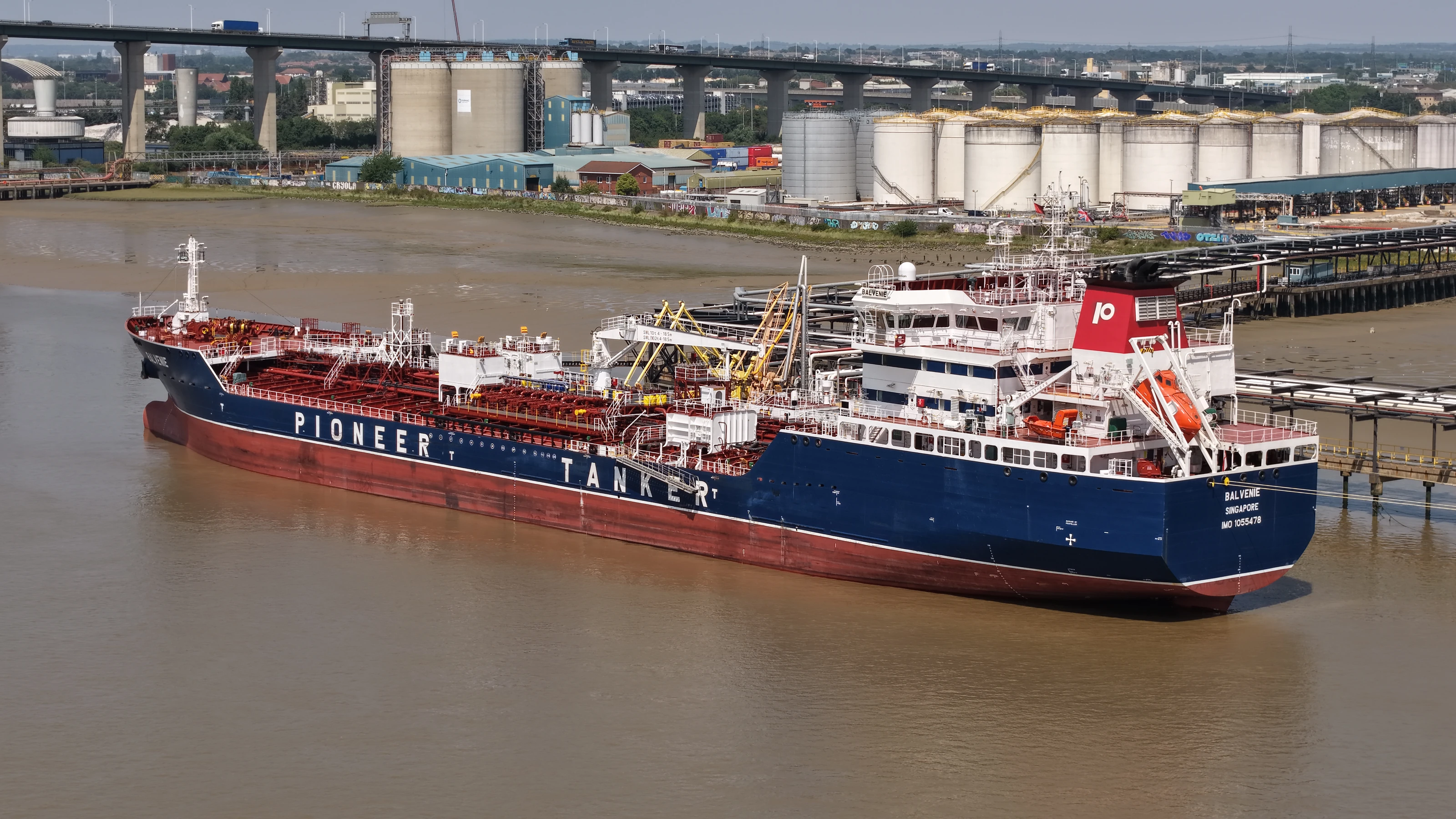
Balvenie is a product tanker registered in Singapore, running in Pioneer Tanker colours. We photographed her alongside a terminal jetty on the lower river with the loading arms connected and her manifold open.
It is worth being precise about what that means, because it is the difference between a photograph of a ship and a photograph of an operation. A tanker at anchor is a shape on water. A tanker alongside with the arms connected is a working link in a supply chain: the cargo is moving, the terminal is running, and the storage behind the jetty is filling or emptying. That is the picture a terminal operator, a charterer or a shipping line wants, and it exists only during the hours the ship is actually working.
Impossible from the ground, obvious from the air
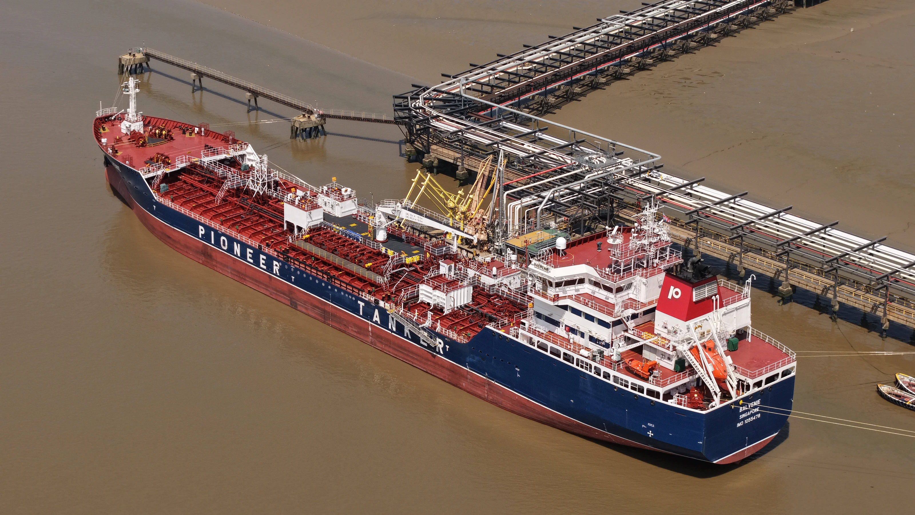
A jetty at deck level is a forest. Gantry legs, pipe racks, walkways, bollards and safety rails stand between you and the vessel, and no position on the quay lets you see the ship and the shore installation in the same frame. Photographers end up with either a detail of pipework or a distant profile of a hull, and neither explains anything.
From above, the whole system resolves at once. Hull, manifold, the run of loading arms across to the shore, the jetty head, the pipe route back to the tank farm and the berth she is lying against. One frame contains the entire operation, and anyone can read it without a caption.
That is why aerial imagery has become standard for marine terminals, and not only for marketing. The same flight produces:
- •Condition records of jetty decks, fendering, dolphins and access walkways that would otherwise need a boat, a cherry picker or rope access.
- •A visual record of berth occupancy and layout for planning and for tender documents.
- •Evidence for insurance and for incident review.
Our asset condition surveys and drone inspection pages cover that side of it.
Standoff is not optional here
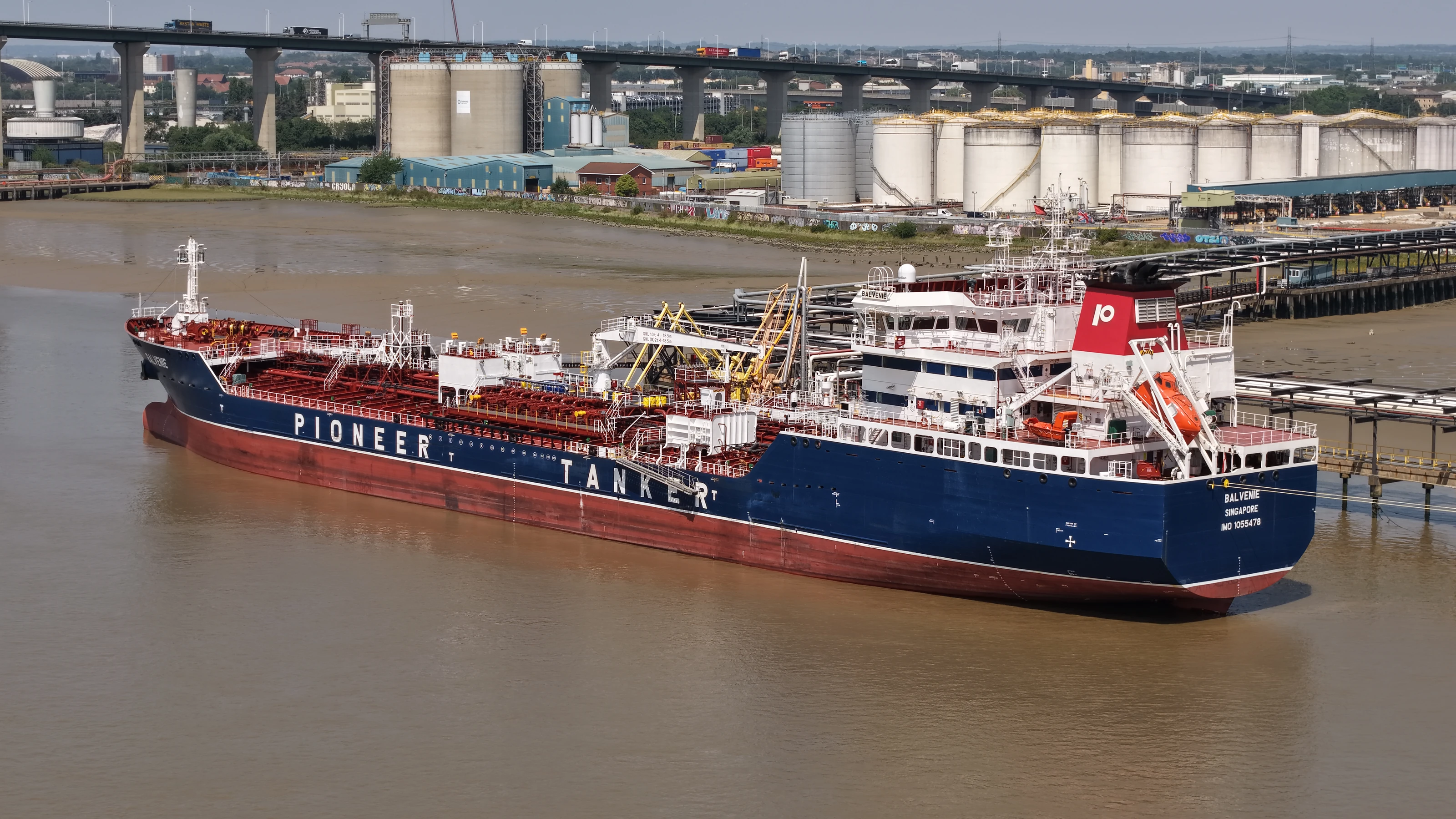
A live cargo transfer is not a place to improvise. Everything in this set was shot from a standoff with the aircraft well outside the jetty limits and clear of the working area throughout.
Terminals are hazardous area sites with their own permit systems, and any aerial work over or near one has to be planned against the operator's rules as well as the aviation ones. In practice that means agreeing the flight in advance, staying outside defined zones, and treating the terminal's own control as the authority on the day. Where a client needs close inspection imagery inside those limits, that becomes a permitted job with a method statement rather than a photo shoot.
The full set is on the Balvenie project page.
These photographs were made independently. We were not commissioned by the vessel's owners, operators or the terminal, and vessel identification is taken from markings visible in the images.
More of our work below the bridges: the PLA harbour launch Kew at the Dartford Crossing and the final tow of HMS President.