

Roof & Asset Condition Surveys in SW20
We cover SW20 for roof & asset condition surveys, with the airspace checks, risk assessment and clearances handled before the crew arrives.
Recent Work
Selected work from across London and the Thames.


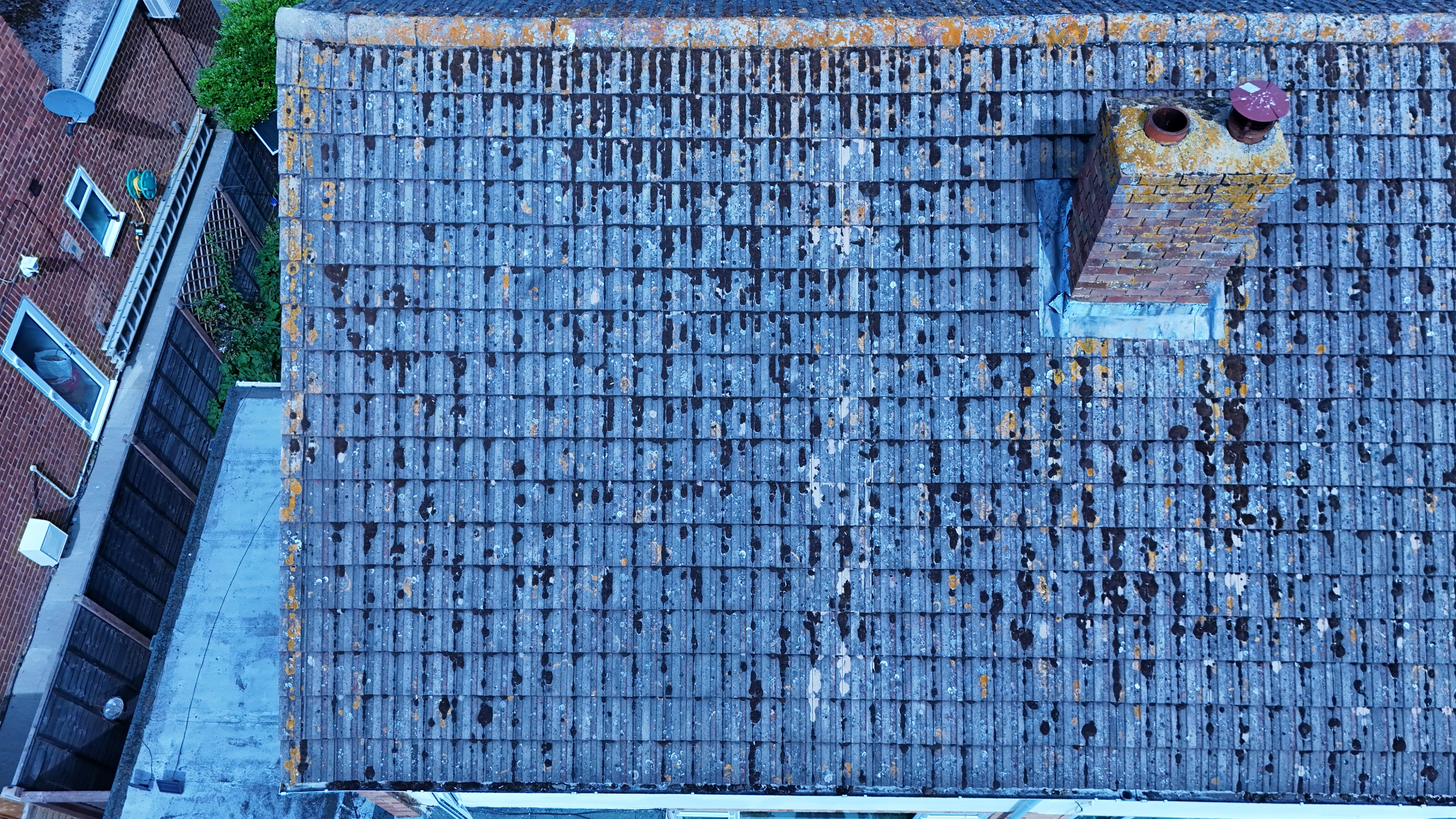
Booking roof & asset condition surveys in SW20 puts a CAA-approved crew on site with the permissions already in place. Jobs come in from main contractors, subcontractors and the client side directly. Repeat visits to the same SW20 site keep the same crew wherever we can manage it.
A drone reaches vantage points in SW20 that scaffolding and cherry pickers cannot justify. Every London district has its own mix of obstacles, and SW20 is no exception. SW20 sits in the South West London postcode area, which our crews cover as one patch.
We confirm what permissions the SW20 site needs before anything is booked in. We fly the aircraft the brief actually needs rather than the same platform for everything. We would rather stand down and rebook than fly a marginal operation.
We are happy to be added to a principal contractor's approved supplier list. Larger data sets are delivered by secure transfer rather than physical media. Nothing about the SW20 operation is subcontracted out without telling you.
What's Included
Get a Quote for SW20
Get in touch to discuss your roof & asset condition surveys requirements in SW20.
Request QuoteOther Services in SW20
Frequently Asked Questions
Do you retain copyright, or do we?
Licensing is agreed before the shoot and written into the quote, so there is no ambiguity afterwards. Tell us how you intend to use the material and we will scope the licence to match.
Do you need us to close anything off while you fly?
Usually not. Most jobs are flown with a small cordon around the take-off point and sensible separation from people on the ground. Where a site genuinely needs more, we will tell you at the planning stage rather than on the morning.
What do we actually receive at the end?
That depends on the brief: graded video, high-resolution stills, orthomosaic maps, 3D models or an inspection report. Raw capture is handed over on the day and finished output follows by secure cloud transfer.