

The tidal Thames is not a free-for-all and it is not run by the council. It has a navigational authority, a harbour master, byelaws, patrol launches and a vessel traffic service directing movements. Understanding it is the difference between a river shoot that happens and one that does not.
People are frequently surprised to learn that the tidal Thames has a government. It has a navigational authority, a harbour master, its own byelaws, a vessel traffic service, patrol launches and rules about who may do what and where.
That authority is the Port of London Authority, and its jurisdiction runs the length of the tideway, from Teddington down to the estuary. If you are planning anything on or above the river, the PLA is part of the picture whether you have thought about it or not.
London VTS
The part that surprises people most is that the Thames is actively controlled, not merely policed.
London VTS is the PLA's Vessel Traffic Service. It monitors and directs movements on the tideway, the way air traffic control does for airspace: watching traffic, managing the sequence of movements, passing information to vessels and coordinating what happens when something goes wrong. Ships and commercial craft report to it, and a large movement through the reaches is a movement VTS knows about in advance.
This matters for anyone planning work on the river, because it means the river's traffic picture is a managed system with a controlling authority in it. A tow, a lift or a passage is not something the operator simply decides to do at a time that suits them. That is also why coordination is the honest answer to "can we film this": the movement you want to cover is already inside somebody else's plan.
What the harbour service launches do
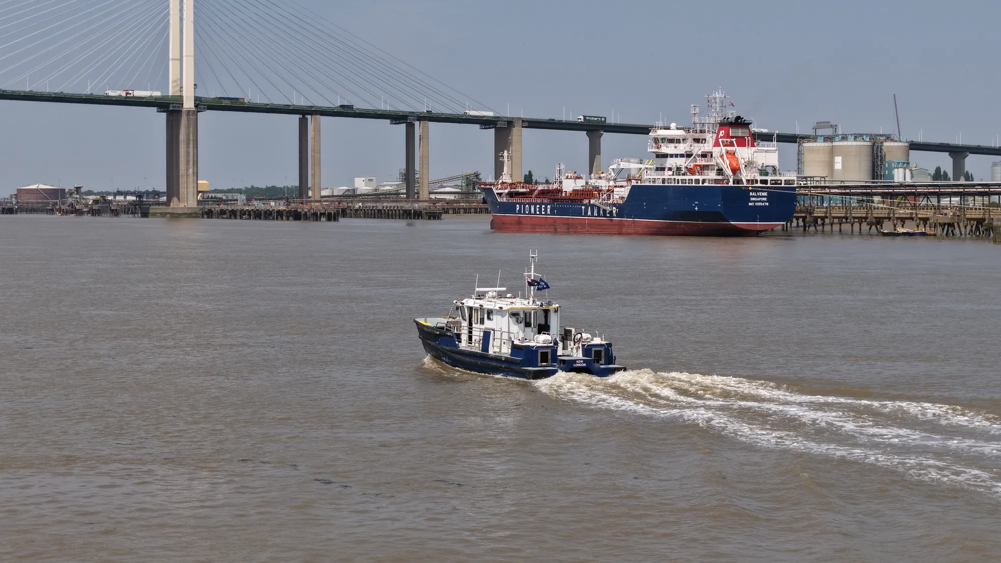
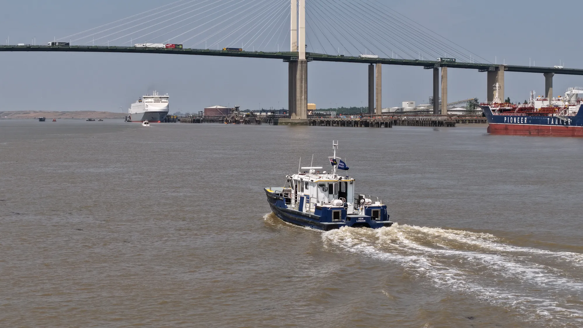
The launches are the visible part of it. Kew is one of them, working the lower river.
Their job is to keep one of the busiest waterways in the country moving safely: supporting pilotage, patrolling, responding to incidents, checking navigational marks, dealing with obstructions and driftwood, attending events, and generally being the presence that makes the rules real. They are the reason the river works, and they are almost never photographed, because to photograph one you have to be on the water with it or above it.
Three separate permission systems, not one
This is the part that catches people out. A commercial aerial shoot over the Thames in London sits inside three overlapping systems, and satisfying one does not satisfy the others.
The aviation system. Whether the flight itself is permitted: the operator's authorisations, the aircraft category, the distances that must be kept from uninvolved people, and, in London, the airspace restrictions that sit over the centre of the city. This is the CAA's territory and it is covered in our guide to drone filming in London's restricted airspace.
The river system. What is happening on the water underneath you: the movements, the events, the works, and the fact that a river with commercial traffic on it does not stop because a camera has arrived. The PLA's interest is navigational safety, and any activity that could affect it needs to be coordinated rather than assumed. Our guide to Thames permits and permissions goes into this in detail.
The land system. Where you are standing. Every launch and recovery point is somebody's property: a borough, a pier operator, a landowner, an estate, Network Rail, a wharf. Permission to fly is not permission to stand somewhere.
A shoot that has cleared the first and ignored the other two is a shoot that gets stopped.
Why the river knowledge is the differentiator
Most of the practical work on a Thames job is not aviation, it is river craft.
Knowing which way the tide is running at a given hour, and therefore which direction vessels will be moving and how fast. Knowing that a tow will be planned around high water and a bridge lift booked around it. Knowing which reaches are busy with passenger traffic at which times, where the fairway sits, which piers are working, and which stretch of foreshore is accessible and safe at a given state of the tide.
Our team came to this from driving boats on this river rather than from flying cameras. That is the reason we can plan around an operation rather than interrupting it, and it is why river operators are comfortable having us there.
The PLA set is on the harbour launch Kew project page. For current official information, timings and notices to mariners, go directly to the Port of London Authority.
These photographs were made independently as part of our record of vessels working the tideway. We were not commissioned by the Port of London Authority and this is not a client credit.
More on how we work on the water: Thames drone services, maritime drone services, or get in touch.