UAS London partnered with Bidston Draughting Ltd to produce a high-density 3D point cloud of an NHS facility in East London using our RTK-equipped DJI Matrice 4E.
High-Density Spatial Capture in Restricted Airspace
UAS London recently deployed our technical drone operations team to East London to conduct a highly precise aerial mapping and structural photogrammetry survey of a prominent NHS healthcare building. Commissioned by **Bidston Draughting Ltd** (a specialist in measured building surveys and detailed drafting services), the core objective was to produce a millimetre-accurate 3D point cloud of the complex facility to support their architectural drawing compilation and BIM modeling workflows.
Operating in London's congested and heavily restricted airspace demands rigorous pre-flight planning. Our experienced flight controllers secured all necessary permissions and NATS airspace clearance before deploying our flagship industrial platform: the **DJI Matrice 4E**.
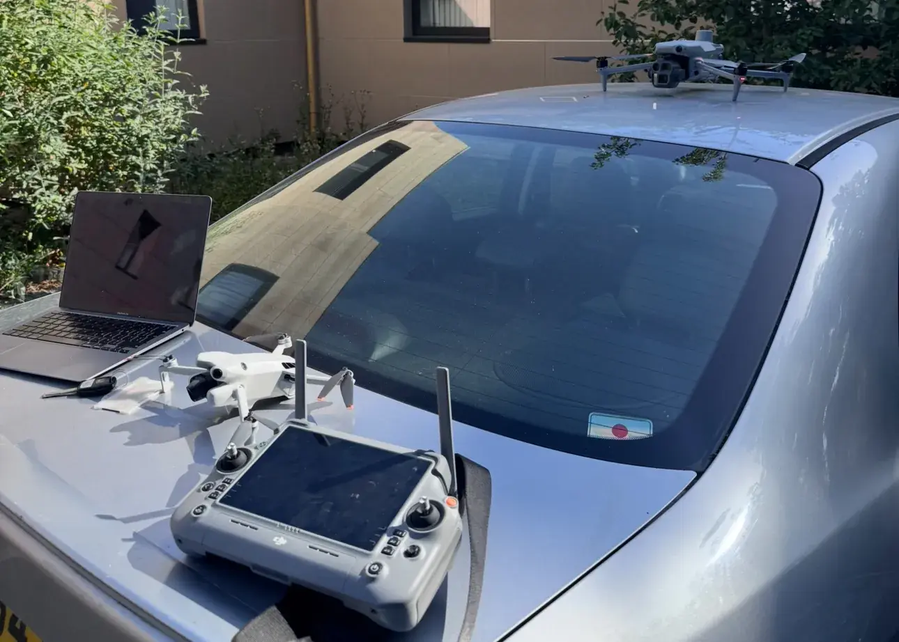
UAS London team deploying the DJI Matrice 4E drone and monitoring software on-site in East London, ready to scan the NHS building.
Precision On-Site UAV Operations
The DJI Matrice 4E is designed specifically for high-accuracy mapping and surveying applications. Equipped with an RTK (Real-Time Kinematic) GNSS module and a high-resolution photogrammetric payload, it allows us to achieve sub-centimetre relative accuracy without necessarily needing extensive ground control networks, although we always check data constraints.
Over the course of the site operation, our pilot executed pre-planned, automated grid flights along with manual orbital passes to capture all facets of the NHS structure: - **Facade Geometry**: Ensuring zero blind spots in deep recesses, window frames, and wall surfaces. - **Roof Layouts**: High-resolution mapping of roof plant machinery, flat-roof conditions, and drainage valleys. - **Adjacent Constraints**: Capturing relative boundaries, pathways, and structural interfaces.
Using our field laptop, the team verified data overlap and alignment in real-time, confirming that the 1,500+ captured RAW images were perfectly focused and contained sufficient coordinate overlap for high-fidelity reconstruction.
Creating the Digital Twin: 3D Point Cloud Processing
Back at our processing suite, the photogrammetry datasets were processed and registered into a georeferenced 3D point cloud. The point cloud maps millions of individual coordinate points in 3D space, capturing the building's physical attributes with incredible detail.
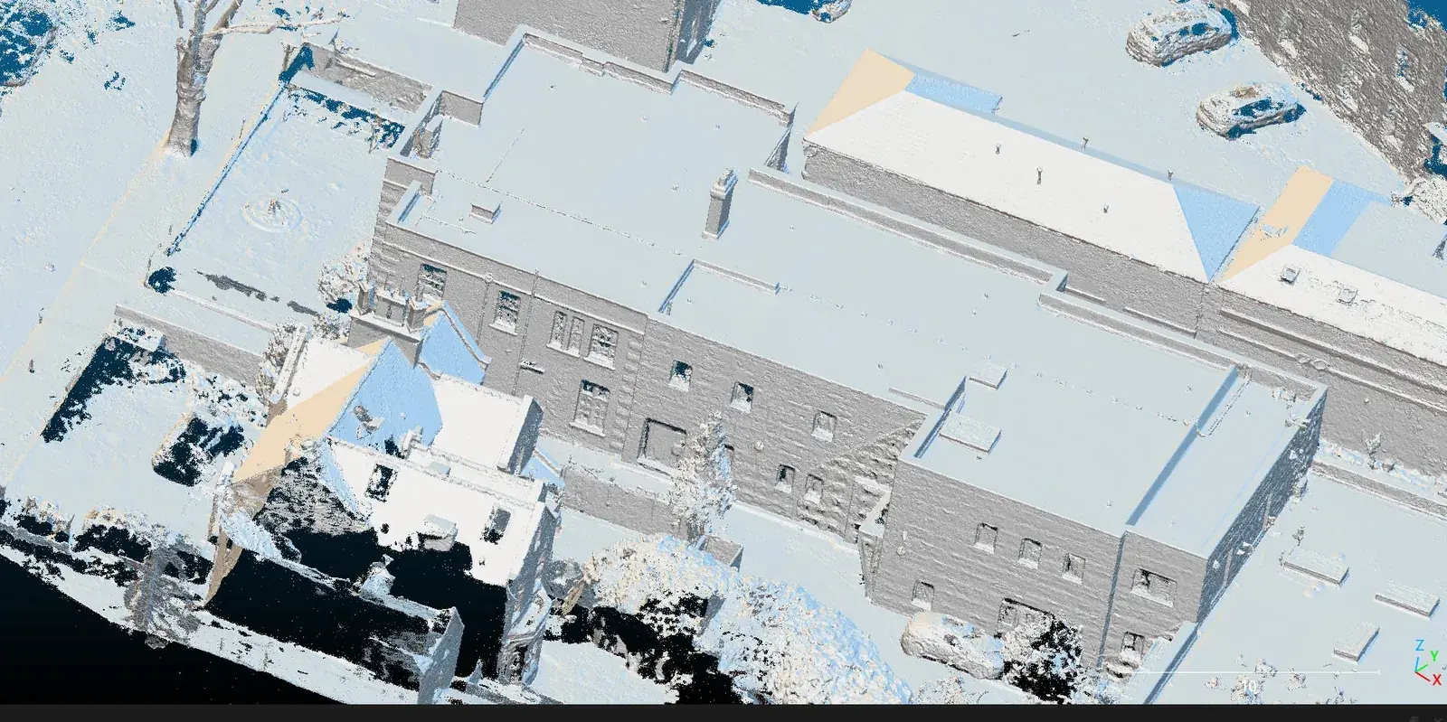
Specialist processing software rendering the final high-density 3D point cloud model of the NHS building.
This point cloud serves as a perfect digital twin of the building. The data was formatted into industry-standard files compatible with AutoCAD and Revit, enabling Jack Bidston and his engineering team at Bidston Draughting Ltd to compile precise elevation drawings, floor plans, and BIM documentation with confidence.
Promoting Bidston Surveys
At UAS London, we believe in partnering with industry leaders. We highly recommend Bidston Draughting Ltd (bidstondraughting.co.uk) for any business requiring expert measured building surveys, drafting support, structural CAD drawings, or architectural modeling. Under the leadership of Director Jack Bidston, they deliver an incredibly professional service that turns raw spatial data into flawless, construction-ready CAD plans.
Elevate Your Project with UAS London
By utilizing UAV surveys instead of manual surveying methods, we eliminated the need for scaffolding, cherry pickers, and working-at-height risk, saving the client significant time and cost.
Whether you require a detailed Drone Survey, high-resolution Drone Mapping & 3D Modelling, or safe and fast Drone Inspections anywhere in London, UAS London delivers cinema-grade results with full regulatory compliance.
Contact our team today to request a quote or discuss your project requirements.